This time, two water exploration and discharge drill holes in the No.6 and No.7 drilling site of the machine lane of a mine in Anhui Province were probed. Due to the inflow of rig emulsion and sealing cement in the drill holes, which resulted in the emulsion in the drill water and the hole wall being stained with white cement, making the video unclear, but the location of the water outflow and the rocky columns in the drill holes can be accurately determined by the logging instrument.
1. Drilling track diagram
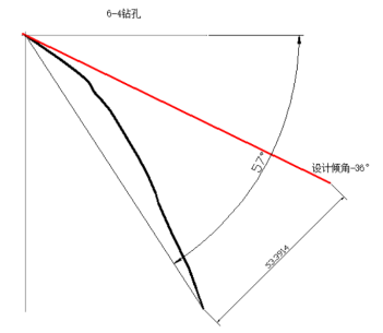
Figure 1 6-4 Drilling inclination trajectory (red design inclination trajectory -36°, black measured inclination trajectory)
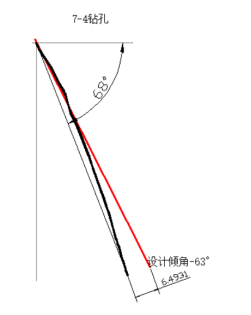
Figure 2 7-4 Drilling inclination trajectory (red design inclination trajectory -63°, black measured inclination trajectory)
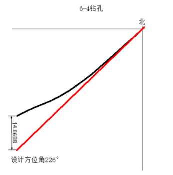
Figure 3 6-4 Drill hole azimuth trajectory (red design azimuth trajectory 226°, black measured inclination trajectory)
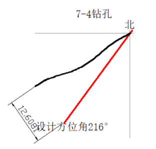
Figure 4 7-4 Borehole azimuth trajectory (red design azimuth trajectory 216°, black measured inclination trajectory)
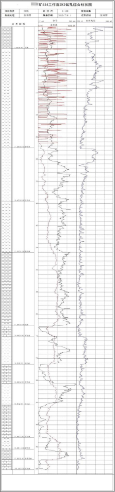 Figure 5 6-4 Consolidated results map
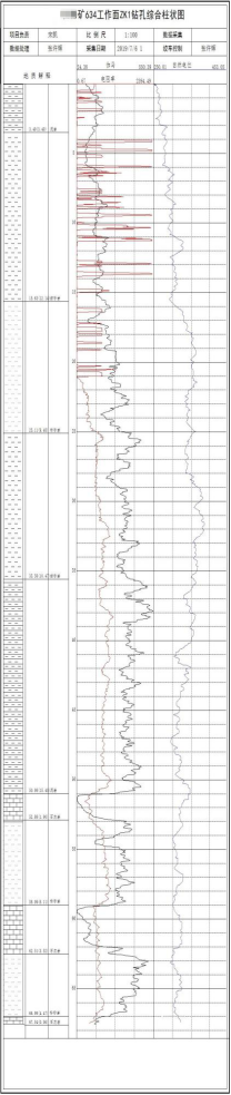 Figure 6 7-4 Consolidated results map
Summarize:The depth of 6-4 casing is determined to be 26.3m and the depth of 7-4 casing is 21m through probing (the resistivity varies greatly in the casing), due to the design of the water discharge location in the three ash, while 7-4 drill hole due to the drilling offset is larger mainly out of the water location in the four ash, the three ash out of the water is small, the 6-4 drill hole of the three ash out of the water is larger, so as to be able to effectively guide the mine to prevent and control the smooth implementation of the project of the water.


 Current position:
 Mining Video Imaging Logging Instrument