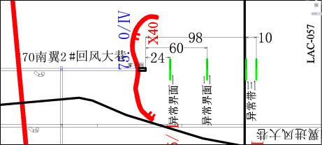
In a mine of Lu'an Mining (Group) Co., Ltd, the head of the 470 south wing 2# return-airway excavation was probed to investigate the geological tectonic changes in the range of 150m in front of the head of the roadway.
2.Construction arrangement
Arrange three-component acceleration detector and acquisition splitter at 22m behind the head of the roadway, arrange two survey lines for the left and right gangs, choose hammering source for the vibration source, and the hammering point is arranged on the side of the detector, each survey line has 6 channels of detector to receive the data, and the excitation spacing of the points is 1m, *** the excitation point is 6m away from the head of the roadway, and the excitation point is 5m away from the detector, and the channel spacing is 1m, as shown in the figure below:

Schematic layout of MTRT construction site
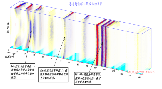
According to the comprehensive analysis of the results of this mine physical exploration and mine geological data, the following conclusions are drawn (see the comprehensive result map for the detailed location):
(1) There is a reflection interface near 24m in front of the digging head, which is presumed to be caused by the development of local fissures in the trap column and the influence of rock layer changes.
(2) There is an anomalous interface II near 60m, which is presumed to be caused by the fissures in the middle of the trap column and the change of rock layer.
(3) The range of 98-108m is the anomaly zone III, which is presumed to be the boundary of the trap column and caused by the influence of the change of coal and rock layers.
Consolidated results map


 Current position:
 Mining Video Imaging Logging Instrument